


FARRELL VTD 02 ED 03, Mercer County, Pennsylvania
About
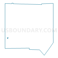
Outline

Summary
| Unique Area Identifier | 661102 |
| Name | FARRELL VTD 02 ED 03 |
| County | Mercer County |
| State | Pennsylvania |
| Area (square miles) | 0.19 |
| Land Area (square miles) | 0.19 |
| Water Area (square miles) | 0.00 |
| % of Land Area | 100.00 |
| % of Water Area | 0.00 |
| Latitude of the Internal Point | 41.20982470 |
| Longtitude of the Internal Point | -80.49039010 |
Maps


Graphs
Select a template below for downloading or customizing gragh for FARRELL VTD 02 ED 03, Mercer County, Pennsylvania


Neighbors
Neighoring Voting District (by Name) Neighboring Voting District on the Map
- FARRELL VTD 01 ED 02, Mercer County, PA
- FARRELL VTD 01 ED 03, Mercer County, PA
- FARRELL VTD 02 ED 01, Mercer County, PA
- FARRELL VTD 02 ED 02, Mercer County, PA
- FARRELL VTD 02 ED 04, Mercer County, PA
- HERMITAGE VTD SW ED 03, Mercer County, PA
- WHEATLAND Voting District, Mercer County, PA
Top 10 Neighboring County Subdivision (by Population) Neighboring County Subdivision on the Map
- Hermitage city, Mercer County, PA (16,220)
- Farrell city, Mercer County, PA (5,111)
- Wheatland borough, Mercer County, PA (632)